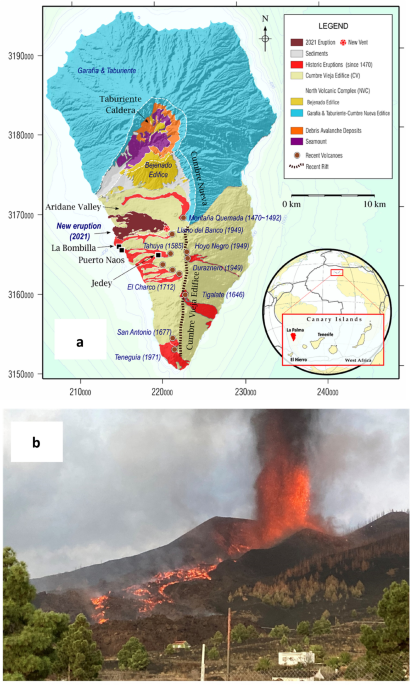
La Palma, Canary Islands, underwent volcanic unrest which culminated in its largest historical eruption. We study this unrest along 2021 using Interferometric Synthetic Aperture Radar (InSAR) and a new improved interpretation methodology, comparing achieved results with the crustal structure. We reproduce the final phase of La Palma volcanic unrest, highligthing a shallow magma accumulation which begins about 3.5 months before the eruption in a crustal volume charactherized by low density and fractured rocks. Our modeling, together with our improved pictures of the crustal structure, allows us to explain the location and characteristics of the eruption and to detect failed eruption paths. These can be used to explain post-eruptive phenomena and hazards to the local population, such as detected gases anomalies in La Bombilla and Puerto Naos. Our results have implications for understanding volcanic activity in the Canaries and volcano monitoring elsewhere, helping to support decision-making and providing significant insights into urban and infrastructure planning in volcanic areas. - READ MORE
By Nature.com
Mon, 12 Dec 2022 10:30:20 GMT


